University of Redlands / ESRI Colloquium Series October 11,


44 Slides7.39 MB
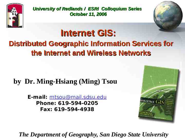
University of Redlands / ESRI Colloquium Series October 11, 2006 Internet GIS: Distributed Geographic Information Services for the Internet and Wireless Networks by Dr. Ming-Hsiang (Ming) Tsou E-mail: [email protected] Phone: 619-594-0205 Fax: 619-594-4938 The Department of Geography, San Diego State University
http://moat.nlanr.net/Software/Cichlid/ What is the Internet? Visualization of the Internetworking
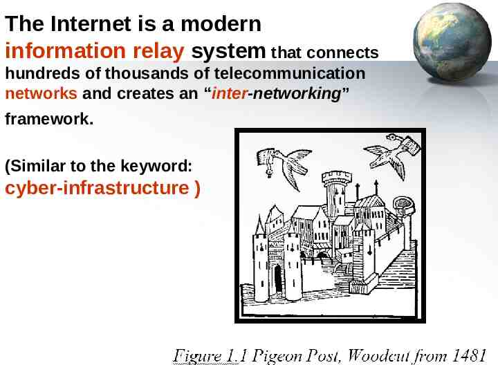
The Internet is a modern information relay system that connects hundreds of thousands of telecommunication networks and creates an “inter-networking” framework. (Similar to the keyword: cyber-infrastructure )
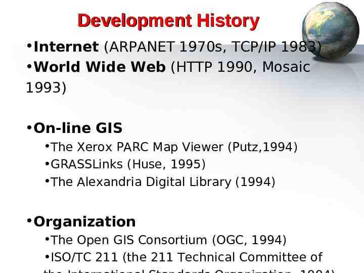
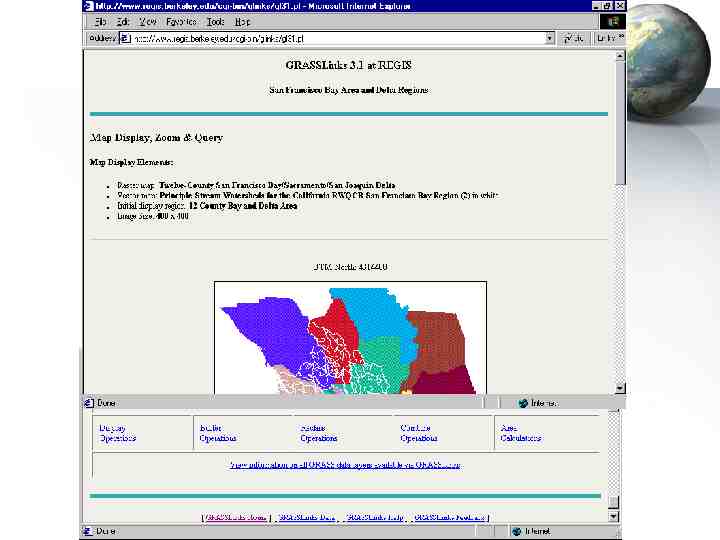
Development History Internet (ARPANET 1970s, TCP/IP 1983) World Wide Web (HTTP 1990, Mosaic 1993) On-line GIS The Xerox PARC Map Viewer (Putz,1994) GRASSLinks (Huse, 1995) The Alexandria Digital Library (1994) Organization The Open GIS Consortium (OGC, 1994) ISO/TC 211 (the 211 Technical Committee of
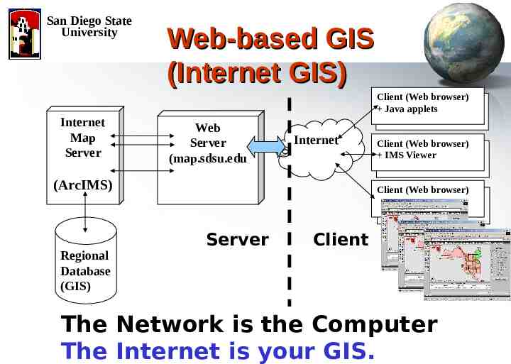
San Diego State University Web-based GIS (Internet GIS) Client (Web browser) Java applets Internet Map Server Web Server (map.sdsu.edu Internet (ArcIMS) Regional Database (GIS) Client (Web browser) IMS Viewer Client (Web browser) Server Client The Network is the Computer The Internet is your GIS.
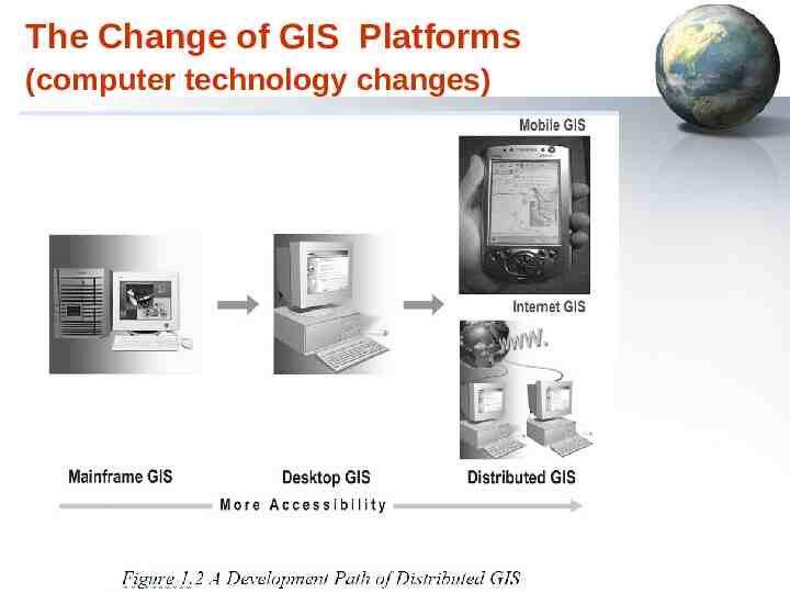
The Change of GIS Platforms (computer technology changes)
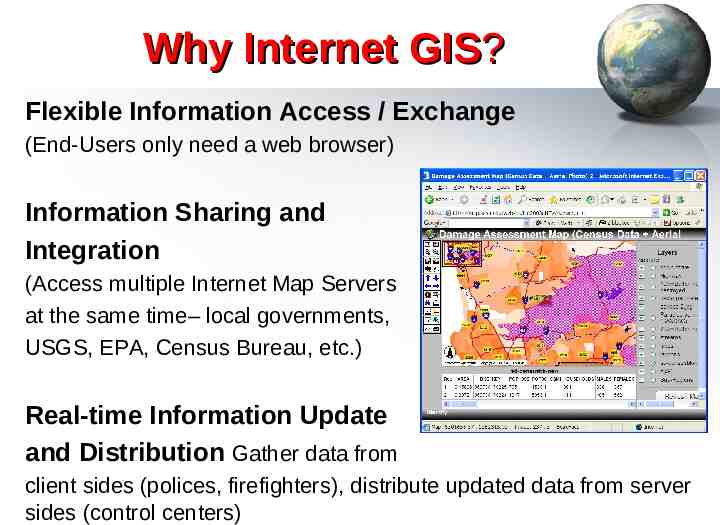
Why Internet GIS? Flexible Information Access / Exchange (End-Users only need a web browser) Information Sharing and Integration (Access multiple Internet Map Servers at the same time– local governments, USGS, EPA, Census Bureau, etc.) Real-time Information Update and Distribution Gather data from client sides (polices, firefighters), distribute updated data from server sides (control centers)
The Three Faces of “GIS” Geographic Information Systems Geographic Information Science Geographic Information Services
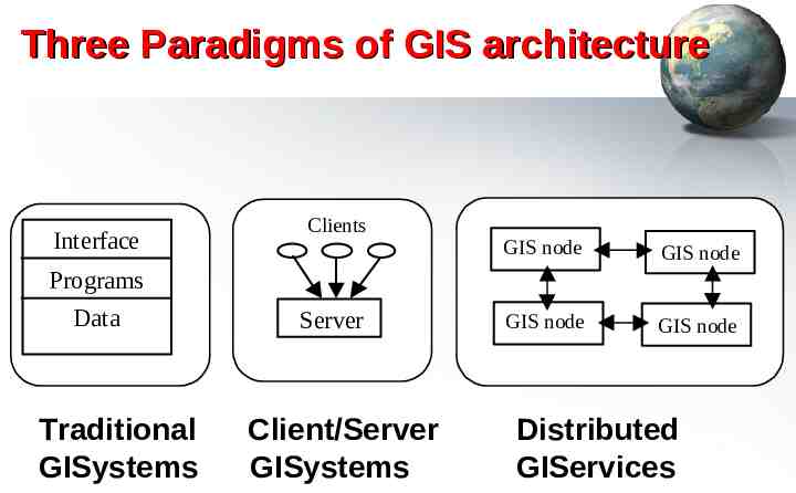
Three Paradigms of GIS architecture Interface Clients GIS node GIS node GIS node GIS node Programs Data Traditional GISystems Server Client/Server GISystems Distributed GIServices
Geographic Information Services GIServices provide a flexible and interactive tools to help users achieve their goals by browsing, searching, processing, interpreting, analyzing, and exchanging geographic information (Tsou, 2005). – Services are user-oriented, customizable, and dynamic. – The Internet and mobile devices are great tools to provide GIServices. (ArcIMS, Mobile GIS, Pocket PC) – Network-based Information Access/Dissemination
Sharing Data, Information, and Knowledge (wildfire example)
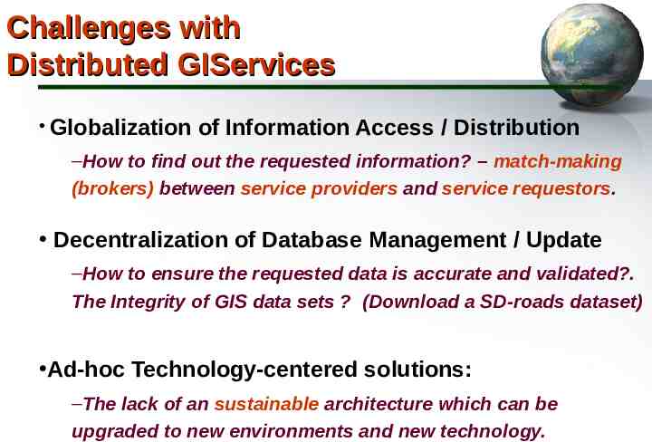
Challenges with Distributed GIServices Globalization of Information Access / Distribution –How to find out the requested information? – match-making (brokers) between service providers and service requestors. Decentralization of Database Management / Update –How to ensure the requested data is accurate and validated?. The Integrity of GIS data sets ? (Download a SD-roads dataset) Ad-hoc Technology-centered solutions: –The lack of an sustainable architecture which can be upgraded to new environments and new technology.
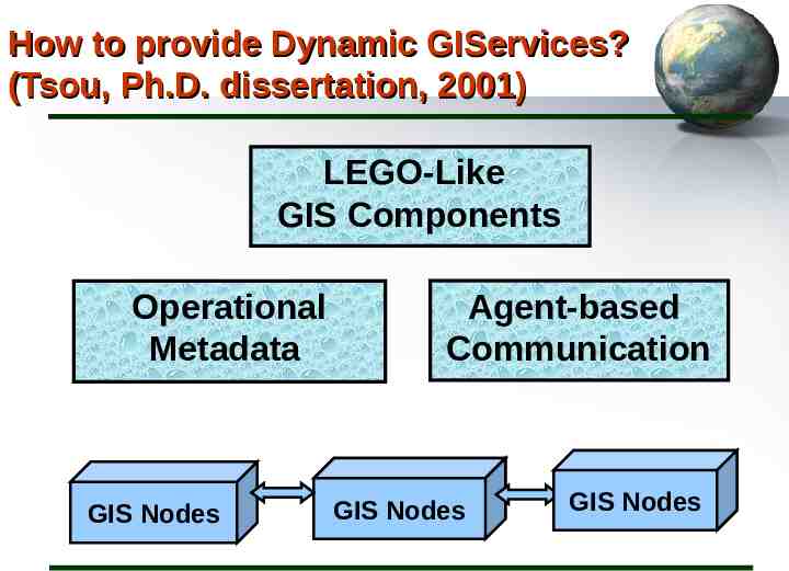
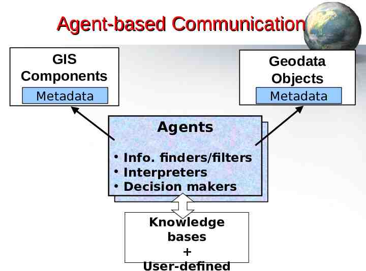
How to provide Dynamic GIServices? (Tsou, Ph.D. dissertation, 2001) LEGO-Like GIS Components Operational Metadata GIS Nodes Agent-based Communication GIS Nodes GIS Nodes
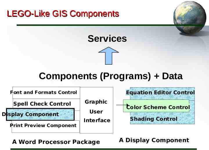
LEGO-Like GIS Components Services Components (Programs) Data Equation Editor Control Font and Formats Control Spell Check Control Display Component Print Preview Component Graphic User Interface A Word Processor Package Color Scheme Control Shading Control A Display Component
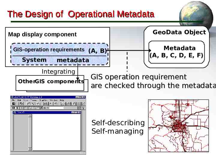
The Design of Operational Metadata GeoData Object Map display component GIS-operation requirements (A, B) System metadata Integrating OtherGIS components Metadata (A, B, C, D, E, F) GIS operation requirement are checked through the metadata Self-describing Self-managing
Agent-based Communication GIS Components Geodata Objects Metadata Metadata Agents Info. finders/filters Interpreters Decision makers Knowledge bases User-defined
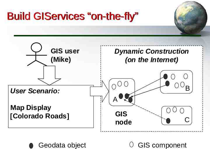
Build GIServices “on-the-fly” GIS user (Mike) Dynamic Construction (on the Internet) B User Scenario: A Map Display [Colorado Roads] Geodata object GIS node C GIS component
Exponential Growth Value As the number of nodes in a network increases arithmetically, the value of the network increases exponentially. (Kevin Kelly, 1998, p. 23. New Rules for the New Economy) 6 (two nodes) 6 9 15 (Three nodes) 15 13 28 (Four nodes) 28 17 45 (Five nodes)
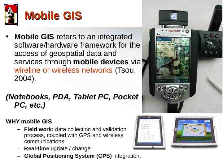
Mobile GIS Mobile GIS refers to an integrated software/hardware framework for the access of geospatial data and services through mobile devices via wireline or wireless networks (Tsou, 2004). (Notebooks, PDA, Tablet PC, Pocket PC, etc.) WHY mobile GIS – Field work: data collection and validation process, coupled with GPS and wireless communications. – Real-time update / change – Global Positioning System (GPS) integration.
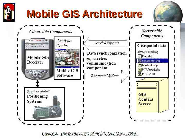
Mobile GIS Architecture
Wireless Mobile GIS Integration Prototype Testing (2003 at MTRP) (Notebook Web Server (IIS) ArcPAD Blue tooth GPS Wi-Fi )
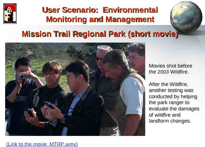
User Scenario: Environmental Monitoring and Management Mission Trail Regional Park (short movie) Movies shot before the 2003 Wildfire. After the Wildfire, another testing was conducted by helping the park ranger to evaluate the damages of wildfire and landform changes. (Link to the movie MTRP.wmv)
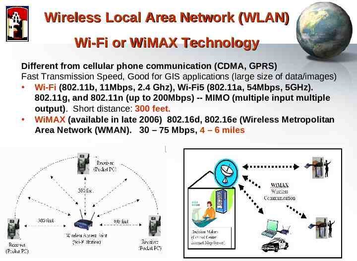
Wireless Local Area Network (WLAN) Wi-Fi or WiMAX Technology Different from cellular phone communication (CDMA, GPRS) Fast Transmission Speed, Good for GIS applications (large size of data/images) Wi-Fi (802.11b, 11Mbps, 2.4 Ghz), Wi-Fi5 (802.11a, 54Mbps, 5GHz). 802.11g, and 802.11n (up to 200Mbps) -- MIMO (multiple input multiple output). Short distance: 300 feet. WiMAX (available in late 2006) 802.16d, 802.16e (Wireless Metropolitan Area Network (WMAN). 30 – 75 Mbps, 4 – 6 miles
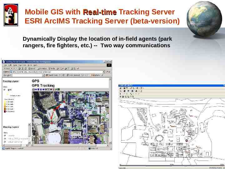
Mobile GIS with Real-time Tracking Server ESRI ArcIMS Tracking Server (beta-version) Dynamically Display the location of in-field agents (park rangers, fire fighters, etc.) -- Two way communications
Future Mobile GIS Development Simplified Mobile GIS User Interface Finger-touch Mobile GIS voice commands (simplified user interface)
Digital Earth (1998) http://www.digitalearth.gov/
San Diego State University What impacts will the development of Digital Earth (3D Virtual Globe) have? The Medium is The Message (McLuhan, 1967) (discussion in 2006 AAG session)
San Diego State University Message behind the Virtual Globes Technology Is Virtual Globe/Google Earth a medium? a new medium? (example: YouTube vs. TV/DVD.) Evolution or Revolution? (linking to traditional GIS tools ) What Messages We Got? (a new paradigm in analyzing geospatial information?). What kinds of impacts for us? (business applications, web services, Geography awareness) The Medium is the Message
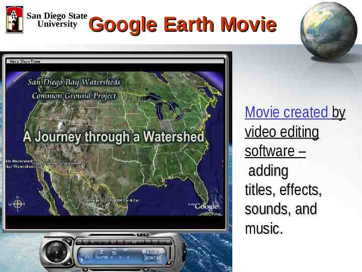
San Diego State University Google Earth Movie Movie created by video editing software – adding titles, effects, sounds, and music.
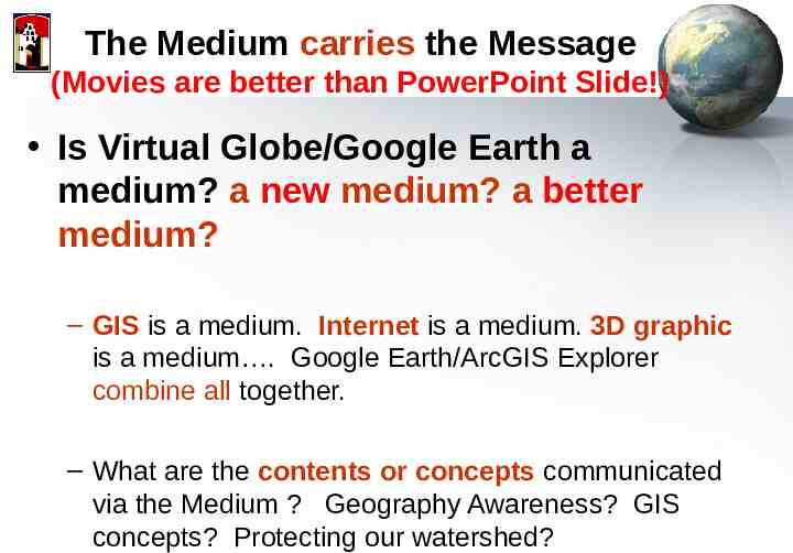
The Medium carries the Message (Movies are better than PowerPoint Slide!) Is Virtual Globe/Google Earth a medium? a new medium? a better medium? – GIS is a medium. Internet is a medium. 3D graphic is a medium . Google Earth/ArcGIS Explorer combine all together. – What are the contents or concepts communicated via the Medium ? Geography Awareness? GIS concepts? Protecting our watershed?
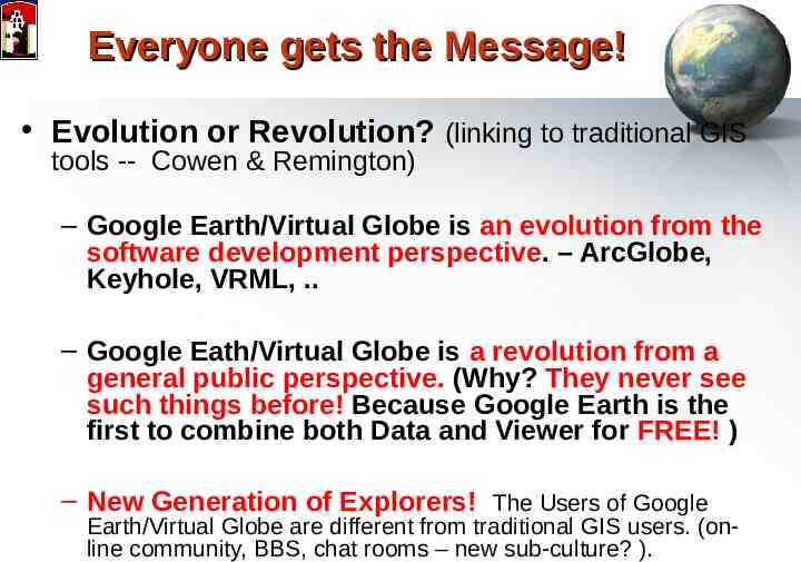
Everyone gets the Message! Evolution or Revolution? (linking to traditional GIS tools -- Cowen & Remington) – Google Earth/Virtual Globe is an evolution from the software development perspective. – ArcGlobe, Keyhole, VRML, . – Google Eath/Virtual Globe is a revolution from a general public perspective. (Why? They never see such things before! Because Google Earth is the first to combine both Data and Viewer for FREE! ) – New Generation of Explorers! The Users of Google Earth/Virtual Globe are different from traditional GIS users. (online community, BBS, chat rooms – new sub-culture? ).
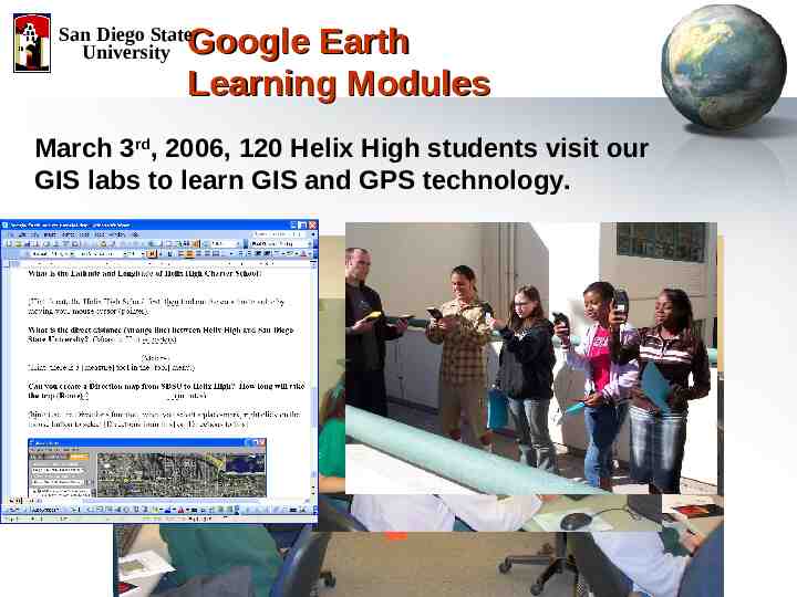
Google Earth Learning Modules San Diego State University March 3rd, 2006, 120 Helix High students visit our GIS labs to learn GIS and GPS technology.
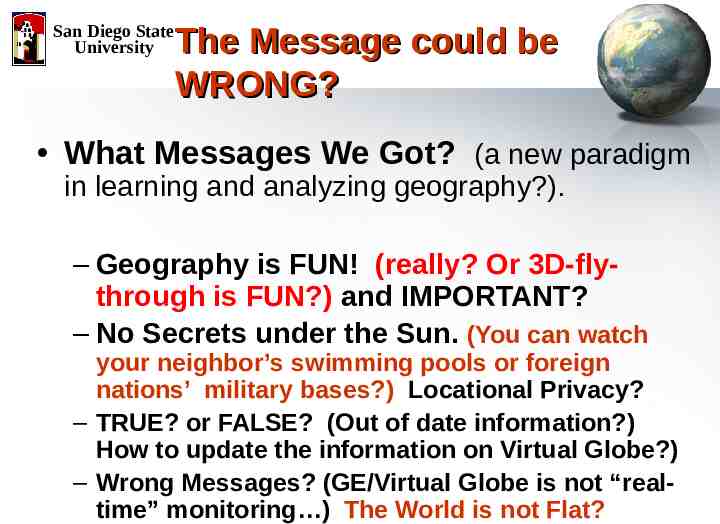
San Diego State University The Message could be WRONG? What Messages We Got? (a new paradigm in learning and analyzing geography?). – Geography is FUN! (really? Or 3D-flythrough is FUN?) and IMPORTANT? – No Secrets under the Sun. (You can watch your neighbor’s swimming pools or foreign nations’ military bases?) Locational Privacy? – TRUE? or FALSE? (Out of date information?) How to update the information on Virtual Globe?) – Wrong Messages? (GE/Virtual Globe is not “realtime” monitoring ) The World is not Flat?
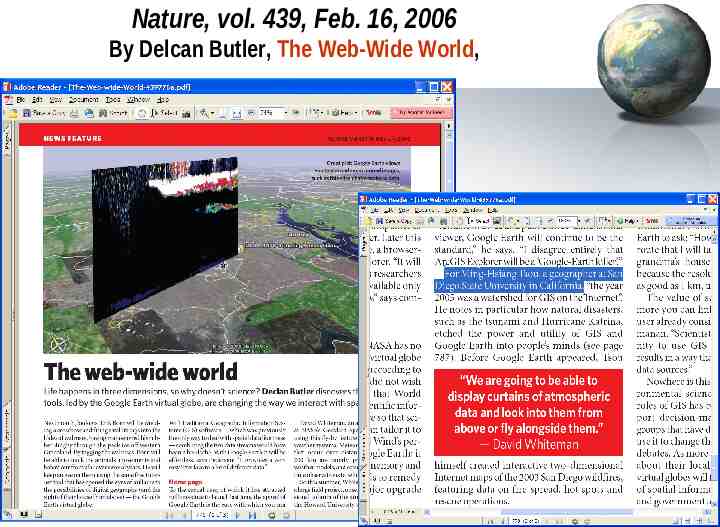
San Diego State University What can We DO? What kinds of impacts for us? (business applications, web services,) – Our Scientific Community (Delcan Butler, The WebWide World, Nature, vol. 439, Feb. 16, 2006). – Our General Public ( disaster management, business models, location-based services, etc.) – Our Geographers -- ? What Geography version 2.0 means? (Alan Glennon).
Nature, vol. 439, Feb. 16, 2006 By Delcan Butler, The Web-Wide World,
Related Links and References Thank You Q&A Http://map.sdsu.edu Http://geoinfo.sdsu.edu Http://map.sdsu.edu/mobilegis Http://www.sdbay.sdsu.edu Http://geoinfo.sdsu.edu/reason Books & Papers (PDF available upon request) Internet GIS (book) http://map.sdsu.edu/gisbook Tsou, M.H. (2004). Integrated Mobile GIS and Wireless Internet Map Servers for Environmental Monitoring and Management, Cartography and Geographic Information Science. 31(3), pp. 153165. Tsou, M.H. (2004). Integrating Web-based GIS and On-line Remote Sensing Facilities for Environmental Monitoring and Management. The Journal of Geographical Systems, No. 6: 1-20.
Back-up slides
NSF- ATE (Advanced Technological Education) Program) 2004 Award – 3 years San Diego State University Mesa College (Community College) San Diego School District (High School) Overview: Provide on-line, Web-based GIS learning modules for high school students and teachers. Provide grounding in fundamental GIS theory and concepts for community college students. Help students assess their interest in and aptitude for GIS-related careers, Form an on-line community and portal for GISeducation research and related projects.
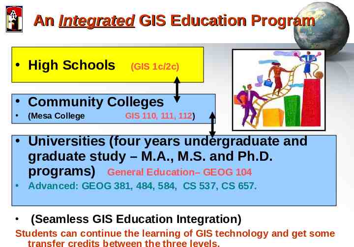
An Integrated GIS Education Program High Schools (GIS 1c/2c) Community Colleges (Mesa College GIS 110, 111, 112) Universities (four years undergraduate and graduate study – M.A., M.S. and Ph.D. programs) General Education– GEOG 104 Advanced: GEOG 381, 484, 584, CS 537, CS 657. (Seamless GIS Education Integration) Students can continue the learning of GIS technology and get some transfer credits between the three levels.
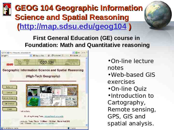
GEOG 104 Geographic Information Science and Spatial Reasoning (http://map.sdsu.edu/geog104 ) ( First General Education (GE) course in Foundation: Math and Quantitative reasoning On-line lecture notes Web-based GIS exercises On-line Quiz Introduction to Cartography, Remote sensing, GPS, GIS and spatial analysis.