Satellites, Weather and Climate Module 2a: Cloud formation & physical
24 Slides7.52 MB
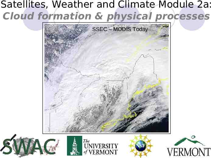
Satellites, Weather and Climate Module 2a: Cloud formation & physical processes SSEC – MODIS Today
Today’s objectives with Clouds Overview of interdisciplinary nature of Atmospheric science What are clouds and how do they form in the atmosphere – physical concepts and atmospheric processes Identifying and classifying clouds Clouds and their impact on weather and climate Actual cloud observing
Introductory Of the Atmosphere
Satellites, Weather and Climate -- SWAC Weather – Describes short term (hours to week(s) state of the atmosphere (i.e. Sunshine, precipitation, temperature, etc) Climate – Describes long term variation of weather at a certain location over a specific time interval (months or longer). Think in terms of averages. Sun provides the energy which drives the complex climate system consisting of multiple feedback processes
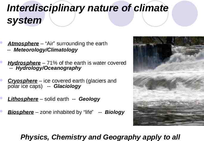
Interdisciplinary nature of climate system Atmosphere – “Air” surrounding the earth -- Meteorology/Climatology Hydrosphere – 71% of the earth is water covered -- Hydrology/Oceanography Cryosphere – ice covered earth (glaciers and polar ice caps) -- Glaciology Lithosphere – solid earth -- Geology Biosphere – zone inhabited by “life” -- Biology Physics, Chemistry and Geography apply to all
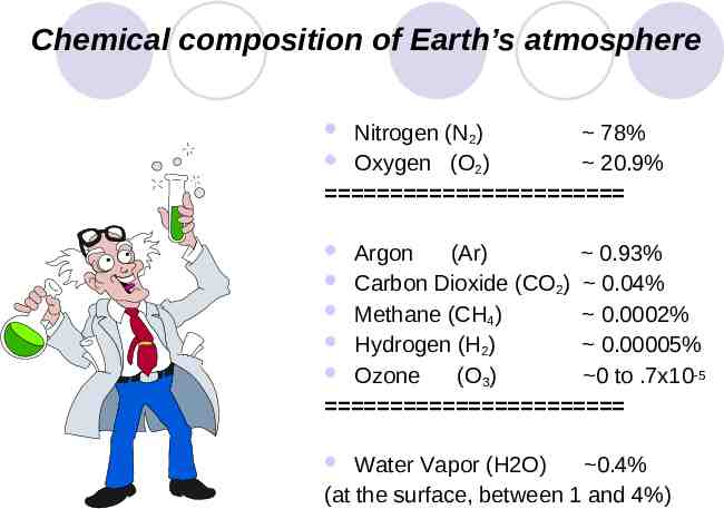
Chemical composition of Earth’s atmosphere Nitrogen (N2) 78% Oxygen (O2) 20.9% Argon (Ar) 0.93% Carbon Dioxide (CO2) 0.04% Methane (CH4) 0.0002% Hydrogen (H2) 0.00005% Ozone (O3) 0 to .7x10-5 Water Vapor (H2O) 0.4% (at the surface, between 1 and 4%)
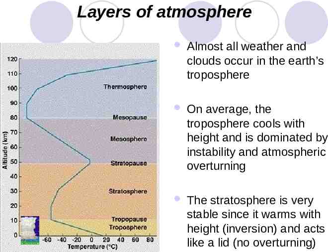
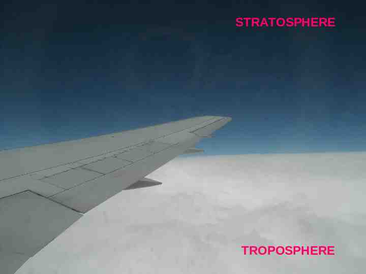
Layers of atmosphere Almost all weather and clouds occur in the earth’s troposphere On average, the troposphere cools with height and is dominated by instability and atmospheric overturning The stratosphere is very stable since it warms with height (inversion) and acts like a lid (no overturning)
STRATOSPHERE TROPOSPHERE
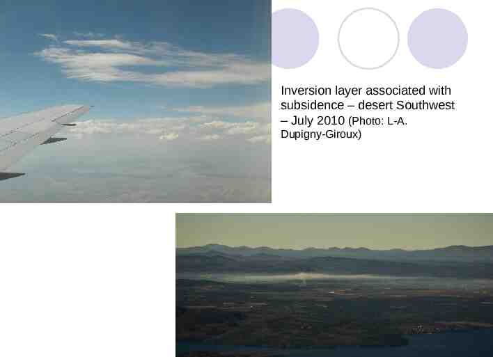
Vertical / thermal profile Lapse rate describes variation of temperature with height. Normally the temperature decreases with height (Troposphere), such as when we climb a mountain This describes an unstable situation (cold heavy air above warm light air) thus we have atmospheric overturning with weather (thunderstorms) and clouds An Inversion is the opposite and is a stable situation (i.e. on a clear cold winter night)
Inversion layer associated with subsidence – desert Southwest – July 2010 (Photo: L-A. Dupigny-Giroux)
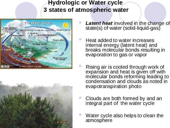
Hydrologic or Water cycle 3 states of atmospheric water Latent heat involved in the change of state(s) of water (solid-liquid-gas) Heat added to water increases internal energy (latent heat) and breaks molecular bonds resulting in evaporation to gas or vapor Rising air is cooled through work of expansion and heat is given off with molecular bonds reforming leading to condensation and clouds as noted in evapotranspiration photo Clouds are both formed by and an integral part of the water cycle Water cycle also helps to clean the atmosphere
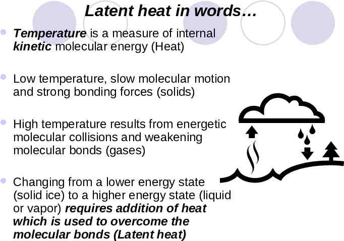
Latent heat in words Temperature is a measure of internal kinetic molecular energy (Heat) Low temperature, slow molecular motion and strong bonding forces (solids) High temperature results from energetic molecular collisions and weakening molecular bonds (gases) Changing from a lower energy state (solid ice) to a higher energy state (liquid or vapor) requires addition of heat which is used to overcome the molecular bonds (Latent heat)
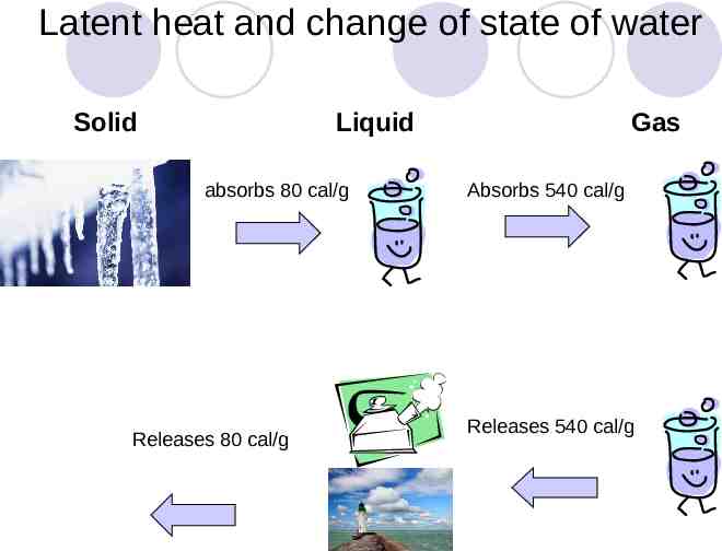
Latent heat and change of state of water Solid Liquid absorbs 80 cal/g Releases 80 cal/g Gas Absorbs 540 cal/g Releases 540 cal/g
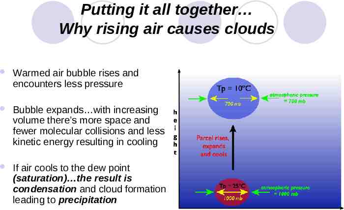
Putting it all together Why rising air causes clouds Warmed air bubble rises and encounters less pressure Bubble expands with increasing volume there’s more space and fewer molecular collisions and less kinetic energy resulting in cooling If air cools to the dew point (saturation) the result is condensation and cloud formation leading to precipitation
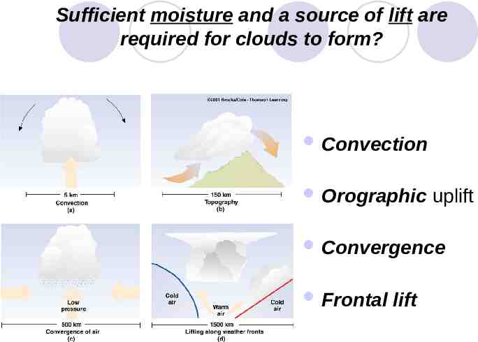
Sufficient moisture and a source of lift are required for clouds to form? Convection Orographic uplift Convergence Frontal lift
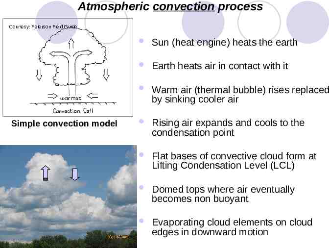
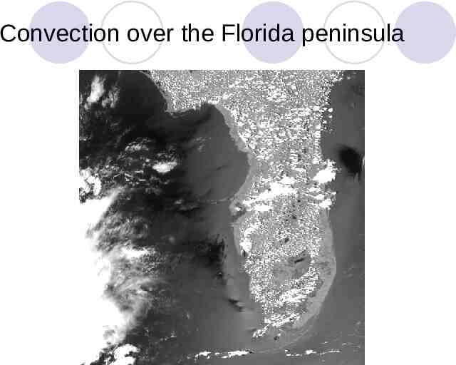
Atmospheric convection process Courtesy: Peterson Field Guide Simple convection model Sun (heat engine) heats the earth Earth heats air in contact with it Warm air (thermal bubble) rises replaced by sinking cooler air Rising air expands and cools to the condensation point Flat bases of convective cloud form at Lifting Condensation Level (LCL) Domed tops where air eventually becomes non buoyant Evaporating cloud elements on cloud edges in downward motion
Convection over the Florida peninsula
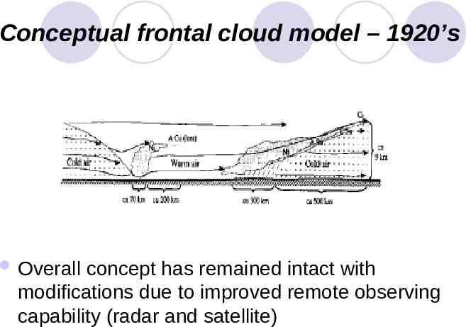
Conceptual frontal cloud model – 1920’s Overall concept has remained intact with modifications due to improved remote observing capability (radar and satellite)
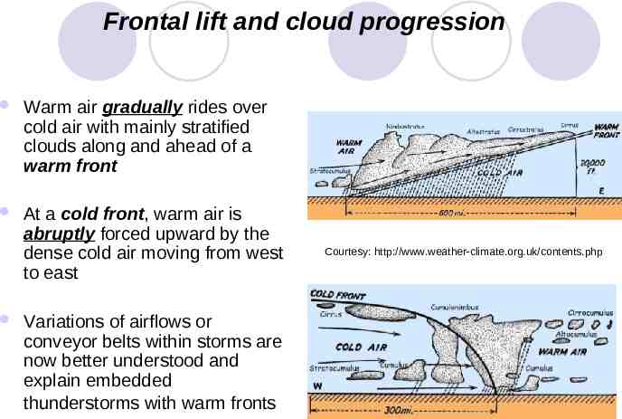
Frontal lift and cloud progression Warm air gradually rides over cold air with mainly stratified clouds along and ahead of a warm front At a cold front, warm air is abruptly forced upward by the dense cold air moving from west to east Variations of airflows or conveyor belts within storms are now better understood and explain embedded thunderstorms with warm fronts Courtesy: http://www.weather-climate.org.uk/contents.php
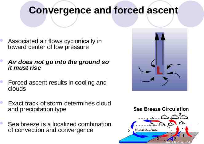
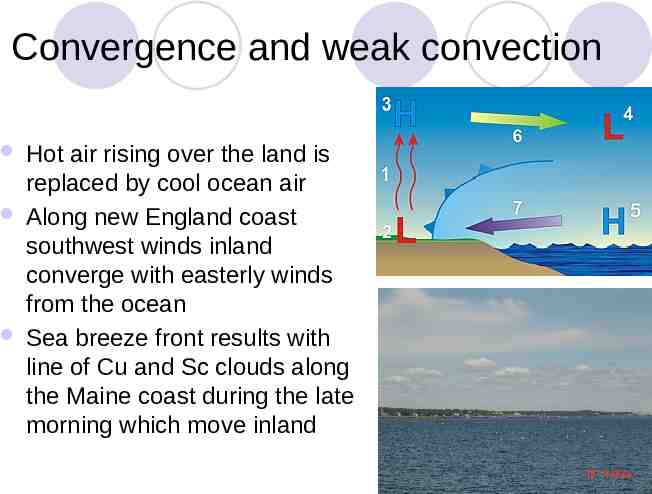
Convergence and forced ascent Associated air flows cyclonically in toward center of low pressure Air does not go into the ground so it must rise Forced ascent results in cooling and clouds Exact track of storm determines cloud and precipitation type Sea breeze is a localized combination of convection and convergence
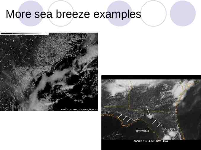
Convergence and weak convection Hot air rising over the land is replaced by cool ocean air Along new England coast southwest winds inland converge with easterly winds from the ocean Sea breeze front results with line of Cu and Sc clouds along the Maine coast during the late morning which move inland
More sea breeze examples
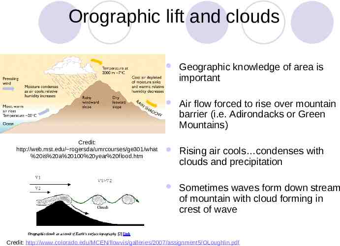
Orographic lift and clouds Credit: http://web.mst.edu/ rogersda/umrcourses/ge301/what %20is%20a%20100%20year%20flood.htm Geographic knowledge of area is important Air flow forced to rise over mountain barrier (i.e. Adirondacks or Green Mountains) Rising air cools condenses with clouds and precipitation Sometimes waves form down stream of mountain with cloud forming in crest of wave Credit: http://www.colorado.edu/MCEN/flowvis/galleries/2007/assignment5/OLoughlin.pdf
