Creating 3D Geological Maps Using Sketch Up Jaime Toro Department of


9 Slides1.12 MB
Creating 3D Geological Maps Using Sketch Up Jaime Toro Department of Geology and Geography West Virginia University On the Cutting Edge - Professional Development for Geoscience Faculty Teaching with New Geoscience Tools: Visualizations, Models, and Online Data University of Massachusetts – Amherst Feb. 11-12, 2008
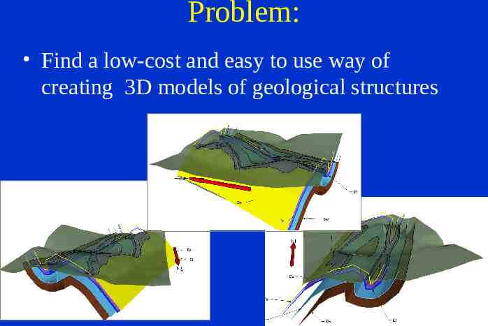
Problem: Find a low-cost and easy to use way of creating 3D models of geological structures
Solution: SketchUp Software for making Architectural 3D Models Widely used in other industries Costs: – SketchUp 6.0– Free (some limitations) – SketchUp Pro 6.0- 495 or Free Educational License Systems: Windows, Mac OS X 10.4
http://www.sketchup.com/
3D Warehouse: Lots of free models of everything http://sketchup.google.com/3dwarehouse
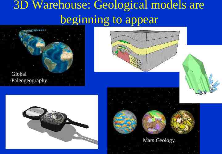
3D Warehouse: Geological models are beginning to appear Global Paleogeography Mars Geology
How SketchUp works Clever user interface for extruding 2D objects Great for architectural stuff (cubes, cylinders, pyramids, etc) It is based on edges and planes, not volumes Not so great for free-form objects, but . http://sketchup.google.com/products.html
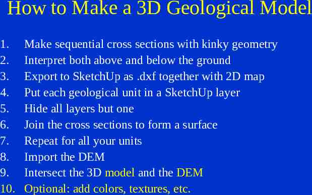
How to Make a 3D Geological Model 1. 2. 3. 4. 5. 6. 7. 8. 9. 10. Make sequential cross sections with kinky geometry Interpret both above and below the ground Export to SketchUp as .dxf together with 2D map Put each geological unit in a SketchUp layer Hide all layers but one Join the cross sections to form a surface Repeat for all your units Import the DEM Intersect the 3D model and the DEM Optional: add colors, textures, etc.
Interaction with other software IMPORT .jpg, .tif, .bmp .dem ESRI shapefiles AutoCAD .dwg, dxf EXPORT Google Earth ArcScene: Import as 3D Marker Symbols AutoCAD .dxf, .dwg .vrml (for GeoWall, etc)